UP TO THE MINUTE


The impacts of an El Niño
By Emma Peterson.
From wildfires to hurricanes, this weather pattern is making its presence known across the United States.
In the last month, wildfires have torn through communities across the United States, especially in the West. As NPR’s Kirk Siegler reports, “Half of the out-of-control wildfires right now in the U.S. are right here in the northwest. Oregon is so far the worst. Roughly a third of all the acres burned in the U.S. total has been in that state. That's a record... There are also problems flaring up in Utah and down in Nevada. And it's not even mid-August [at the time I’m reporting].”
And unfortunately, for many experts and even residents, this intensive wildfire season does not come as a surprise. In fact, as early as April 2026, the National Oceanic and Atmospheric Association (NOAA) was warning of a bad season ahead. How were they making this prediction? By watching an El Niño develop.
What is an El Niño?
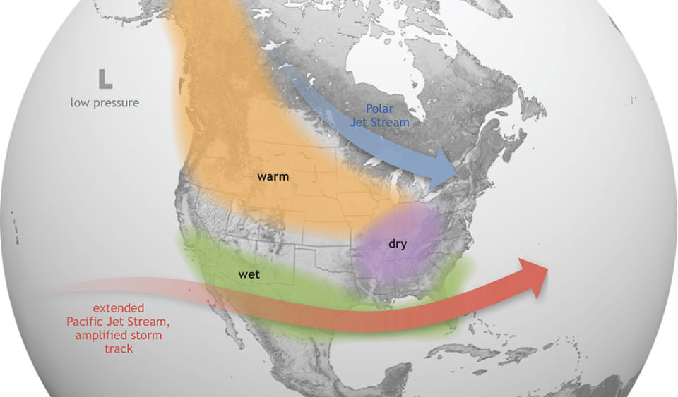
An El Niño is a part of a larger weather pattern in the Pacific Ocean called the Southern Oscillation (ENSO). The other half of this pattern is called La Niña. NOAA describes ENSO as “arguably the most influential climate driver on Earth... as cycles of warm and cool waters in the central and eastern equatorial Pacific alter where ocean heat is released into the atmosphere, affecting atmospheric circulation, temperatures and precipitation around the globe.”
The current phase of ENSO we are in is the El Niño, which is characterized by the weakening of the east-to-west Pacific Trade winds and the movement of warm surface water East, towards the coast of South America. The results of these movements impact the weather system in the overall jet stream, which changes regional precipitation and leads to conditions like we see today with the wildfires.
More than wildfires
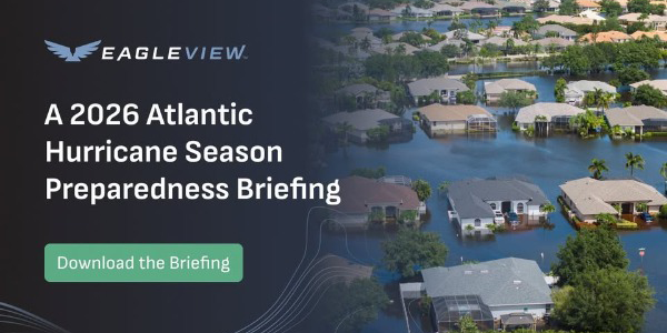
Wildfires might be the most obvious result of the El Niño right now, but other weather events like hurricane season should not be overlooked. In fact, Eagleview, one of the leaders in aerial imagery and geospatial intelligence, just released a report highlighting one of the more subtle risks of this weather patterns – hurricanes.
The report, which was put together by Briget Grbic, VP of strategic operations, and Joe Oddi, director of partner strategy, explains:
The 2026 Atlantic hurricane season officially runs from June 1 through November 30. Leading forecasting institutions — including Colorado State University (CSU), AccuWeather, and the National Oceanic and Atmospheric Administration (NOAA) — are projecting a well below-average season, driven primarily by the El Niño conditions in the equatorial Pacific.
At first glance, a below-average season sounds like a good thing! However, below-average does not mean zero storms and we all know it only takes one storm to create a catastrophe. Briget and Joe point to the 1992 Atlantic hurricane season as an example of this. This season was far below average with only six named storms. Unfortunately, one of those storms was a Category 5 hurricane. Named Hurricane Andrew, that is remembered as “one of the most destructive natural disasters in American history.”
The 2026 season
Looking at this upcoming season, with the predicted lower storm numbers, Briget, Joe and the Eagleview Weather Team raise concerns about a similar situation arising. Their concerns are based on three main factors:
- Rapid intensification: It has become more frequent for the maximum sustained winds to be higher (above 35 mph) within 24 hours in the Atlantic region. In fact, research “published in Nature Communications and the Bulletin of the American Meteorological Society indicates that the proportion of Atlantic hurricanes undergoing RI has increased significantly since the 1980s.” The result of this trend is that storms can grow far bigger and more dangerous in just a short window of time.
- Sea level rise: Along the Atlantic and Gulf coasts, sea levels have been rising in the past few decades. The result? Higher risk of coastal flooding as a “Category 2 hurricane in 2026 can produce surge impacts equivalent to what a Category 3 would have produced in 1990.” These surges are incredible dangerous, as seen in Hurricanes Harvey (2017), Florence (2018) and Ida (2021).
- Coastal development: Coastal communities in the United States have grown substantially over the years. This creates added risks in the face of storms such as:
- Greater life-safety exposure during events
- Higher potential property losses
- More complex evacuation logistics
- Greater demand on post-storm damage assessment and recovery resources
- Hazardous material
All three of these factors point to one conclusion – there might be fewer storms this year, but when one hits, it still has the potential to be a massive catastrophe.
Eagleview’s role in preparing
Putting together this report is just the first step in how Eagleview is preparing for the 2026 Atlantic Hurricane season. They have both a dedicated Weather Team (which tracks forecasts and storm development) as well as a Disaster Response Team that partners with organizations like FEMA, National Weather Service, National Hurricane Center, U.S. Army Corps of Engineers, National Guard and State Emergency Management Agencies to make sure teams on the ground have aerial images and damage assessment capabilities.
Learn more about EagleView One in their Coffee Shop directory or visit www.eagleview.com.
About the author

Emma is the senior content developer at The Coffee Shops and AskARoofer™. When she's not working or overthinking everything a little bit, she enjoys watching movies with friends, attending concerts and trying to cook new recipes.
Recommended For You

How to Prevent Moisture Damage
Read More ...
Hidden strength beneath the roof
Read More ...
Fortify your roof before the storm hits
Read More ...
UP TO THE MINUTE

Comments
Leave a Reply
Have an account? Login to leave a comment!
Sign In